Funchal
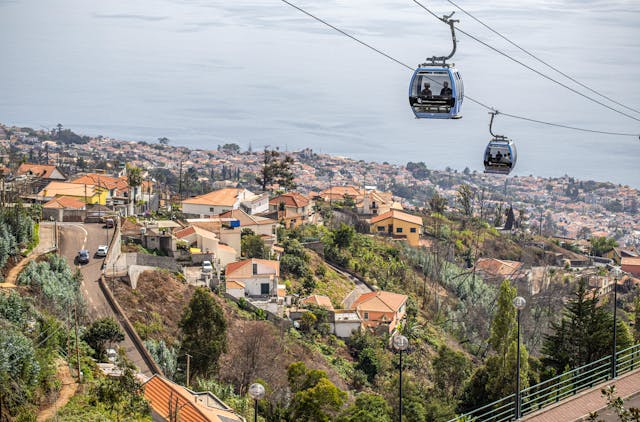
Capital city, deepwater cruise berths, and south bay amphitheater.
Shows cruise berths alongside, harbour chop, and low cloud inside the bay bowl. When grey cloud settles over Funchal, coastal positions to the west often remain dry.
High volcanic crest separating northern and southern weather systems.
Compare cloud levels at 1,818m, 1,592m, and 1,064m before driving up.
Showing 3 / 3
Practical travel and observation notes for High Peaks & Mountain Trails (1,400 m - 1,862 m (Poiso pass to Pico Ruivo summit)).
Drive up ER218 early if the camera shows clear blue skies over the cloud deck; abort if Poiso (1,412 m) and Areeiro (1,818 m) are both in grey cloud.
If the path is grey, the ridge is in cloud. Funchal can still be sunny. It is about 10 to 15 degrees colder up here than on the coast. The camera at Pico do Areeiro looks at the car park and the start of the path, not the radar dome.
In frame: Whether the path at the car park is clear or grey. Grey means the ridge is in cloud.
Limitations: Trail safety along PR1 Vereda do Areeiro. Severe wind gusts through the narrow Pedra Rija knife-edge, damp tunnels, and ice on northern shaded steps cannot be detected on camera. Always verify official IFCN trail status.
To Achada do Teixeira (Pico Ruivo northern approach): 55-65 min from Funchal via VR1 and VE1/ER101 to Santana (52 km).
Pico do Areeiro upper lot (1,818 m) holds only ~80 vehicles and fills completely by 06:15 during summer sunrise months (April to October). Strict police enforcement; parking on road verges risks fines and towing. Achada do Teixeira (1,592 m) has ~120 marked spaces and fills by 09:30 on weekends.
Official daily status and permit booking for PR1, PR1.1, PR1.2, PR1.3
Meteorological warnings and summit temperature bulletins
Active road closures, high-wind alerts, and emergency notices
Peak elevations: official Portuguese cartography (IGeoE). The airport runway is at Santa Cruz, over the sea. Local time: Atlantic/Madeira.
contact@webcammadeira.comPico do Areeiro is the car park and the start of the path, not the radar dome. If that path is grey, the ridge is in cloud. Funchal can still be sunny. The walk from Pedra Rija toward Pico Ruivo is one-way. Achada do Teixeira, at 1,592 m, is the other picture: the plateau and the start of the 2.8 km walk, not the summit. It is about 10 to 15 degrees colder than Funchal. There is no regular bus, and the car park fills early.
Capital city, deepwater cruise berths, and south bay amphitheater.
Shows cruise berths alongside, harbour chop, and low cloud inside the bay bowl. When grey cloud settles over Funchal, coastal positions to the west often remain dry.
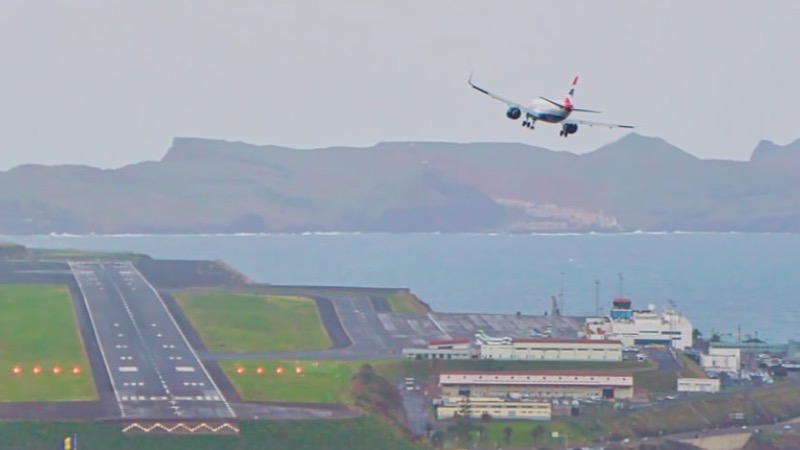
The runway at Santa Cruz, built out over the sea. Not your gate, your bag, or the delay.
The picture is the runway and the approach. It is not your gate, your bag, or whether the flight is late. White water means a bumpy landing.
Coastal wave checks across western point breaks and northern beach lines.
Jardim do Mar and Paul do Mar show breaking wave sets on boulder reefs, while Seixal reveals the black sand surf line. Useful for reading lineup shape, but a camera still is never a marine safety clearance.
Basalt cliffs, volcanic rock pools, and black sand beaches.
Displays ocean spray over Porto Moniz natural pools and Seixal beach. Dense white foam over the outer barrier often signals overwash risk across the swimming platforms.
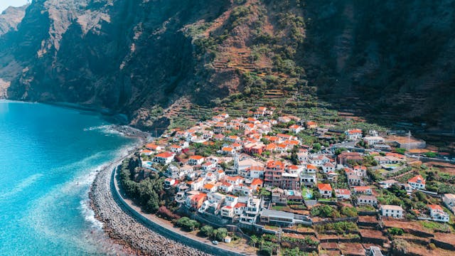
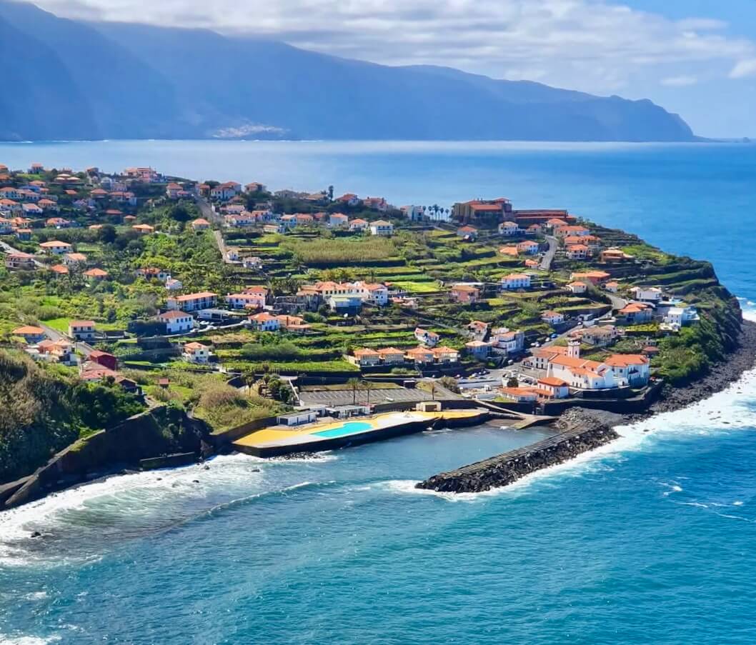
Terraced valleys, coastal headlands, and traditional cliffside communities.
Santana, Faial, and São Jorge capture moist trade-wind air pushing ashore. Low mist often covers rural ridges here while the south coast enjoys clearer skies.
Sheltered sand bay, industrial harbor, and Ponta de São Lourenço trail base.
Covers Machico bay, Caniçal cargo berths, and Santa Cruz. Machico water is usually calm during northerly swells, but remains vulnerable to easterly wind chop.
Warmest leeward coastal belt sheltered by the Paul da Serra plateau.
Ponta do Sol, Calheta, and Madalena do Mar frequently stay bright when Funchal and northern valleys sit under cloud. A clear feed here marks a reliable choice for outdoor warmth.
PR1 Vereda do Areeiro Trailhead
1818 mImage by NetMadeira
PR1.2 Shortest Route to Pico Ruivo
1592 mImage by NetMadeira
PR6 Levada das 25 Fontes & PR6.1 Risco
1064 mImage by NetMadeira