PR27central massif • MODERATE4,50 €
Glaciar de Planalto
Bica da Cana to ER 105
High plateau route; officially closed; confirm on the IFCN list before planning.
Distance4.6 km
Bica da Cana to ER 105
High plateau route; officially closed; confirm on the IFCN list before planning.
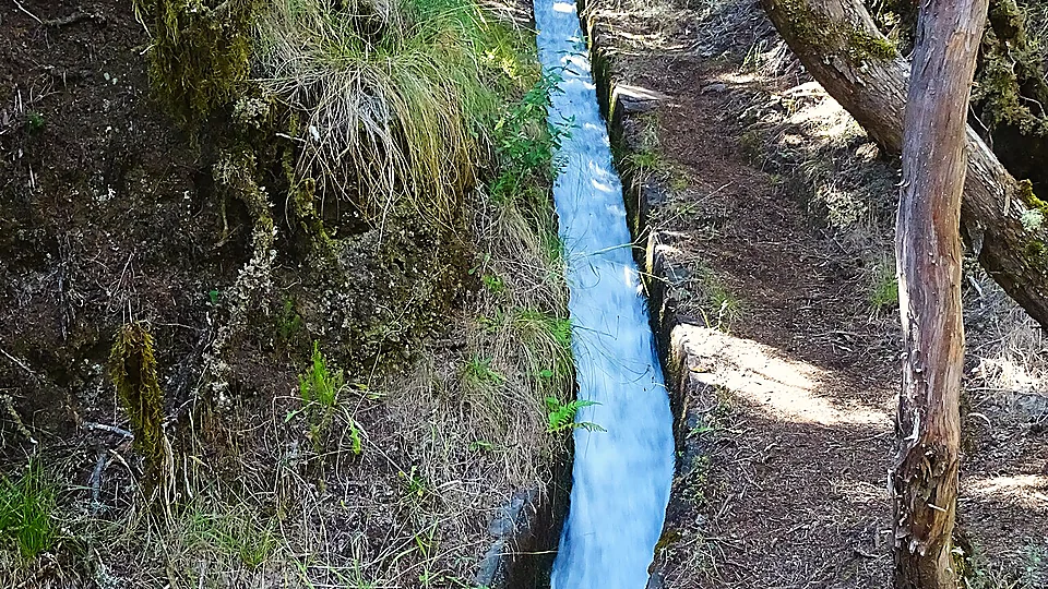
IFCN has closed access because of rockfall, unstable ground, or gales. Respect all barriers.
“ENCERRADO segundo lista oficial IFCN.”
Official trail closure or summit gale gusts exceed safety thresholds. Conditions will not clear sufficiently today.
Leave exposed ridges or unlit levadas at least 2 hours before dusk.
Walkers without proper boots. Mud and rock can be slippery.
Not a live timetable. Colors match the map: bus, walk, taxi gap. Clocks appear only from a full PDF or from the Horários do Funchal feed. Where there is no bus: licensed taxi or private transfer. The taxi lines use the 2026 IMT meter on named road kilometres. This site does not book the ride.
Hike
Hike between trailheads, about 2.5 hours. That figure is the trail estimate, not a bus time.
Classified PRs need a Simplifica booking, including RAM residents who pay nothing. A paid booking does not open a closed trail.
Camping only in IFCN zones, licence on Simplifica, €5 per tent per night. Wild camping and fires are not allowed.
Temperatures on Madeira drop by roughly 6.5°C per 1,000 metres of elevation. High ridges are significantly colder and windier than the coast.
Cross-section of the route relative to the trade-wind cloud layer (Mar de Nuvens), tunnel sections, and exposed cliff edges.
PR27 rises from 1200m to 1560m over 4.6 km. Estimated cloud base is about 800m with tops near 1250m. High summits can sit above the cloud sea in dry sunshine (inversion).
Official gear guidelines, tunnel safety requirements, and conservation fees for this specific route.
2026 fees (IFCN)
| One classified trail (except PR1 full) | €4.50 |
|---|---|
| PR1 full route (Pico do Areeiro → Pico Ruivo) | €10.50 |
| 1-day pass (several trails, not PR1) | €9.00 |
| 3-day pass (not PR1) | €22.50 |
| 7-day pass (not PR1) | €52.50 |
Combined passes do not cover the full PR1 crossing.
European emergency number: 112
Regional civil protection: +351 291 700 112
Deep canyons and tunnels often have no mobile signal.
Maintained by local editors in Madeira. Not an official emergency service. Always yield to on-site ranger instructions.
Do not walk past closed gates. These alternative Madeira walking routes avoid the summit cloud deck or storm front and are officially open in the IFCN register today.
Fajã da Ama to Ribeira do Inferno
Sunny area situated safely below the cloud ceiling.
Highest point is 600m (960m lower than Bica da Cana to ER 105). Situated well beneath the condensation cloud layer.
São Jorge to Ribeiro Bonito
Sunny area situated safely below the cloud ceiling.
Highest point is 540m (1020m lower than Bica da Cana to ER 105). Situated well beneath the condensation cloud layer.
Portela – Maroços
Sunny area situated safely below the cloud ceiling.
Highest point is 600m (960m lower than Bica da Cana to ER 105). Coastal sea-level sunshine and volcanic peninsula views.
Astronomically calculated for 1560 m elevation (1.16° horizon dip). The sun crests about six minutes earlier than sea level in Funchal.
Depart Funchal by 06:35 to secure trailhead parking before the lot fills (around 06:15) and reach the viewpoint ahead of first civil light (07:40).
The official IFCN status for PR27 Glaciar de Planalto is currently CLOSED. Mountain trail access is updated by IFCN for rockfall, wet rock, or gale warnings. Physical trailhead barriers and ranger notices always override online statuses.
Mountain weather across Madeira differs drastically from Funchal. At PR27 (spanning 1200m to 1560m), trade winds often create a thick cloud layer between 1,000m and 1,400m while the highest peaks may sit in clear sunshine. Check the live mountain camera above before setting out.
No specific access fee is currently mandated for this trail, subject to standard regional environmental conservation rules.
Never bypass closed gates or warning tape. If the central peaks or northern levadas are closed by weather, the East Coast (PR8 Ponta de São Lourenço) or lower southern levadas typically provide dry, sunny fallback conditions.
This is a linear one-way traverse (4.6 km). Start and end points are in different valleys. Pre-book your taxi or private return shuttle, as remote mountain trailheads (e.g. Achada do Teixeira) have no regular bus service.