📹Reis Magos
Caniço •Offline
Southeast
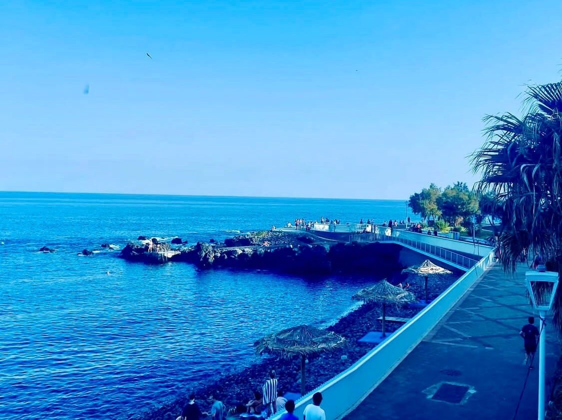
Reis Magos presents an incredibly distinct geographical footprint situated quietly within the limits of the Caniço parish. I always remind visitors that the heavy topographical isolation here effectively shielded this specific coastal sector from the large commercial shipping operations that permanently altered other regional harbors. You evaluating the immediate shoreline confront a physical environment composed entirely of rounded volcanic stones transitioning abruptly into poured municipal concrete. The town actually constructed an exact 650-meter promenade directly along the edge to safely facilitate public ocean access. If you plan to drive down during peak summer months, you should expect the small local parking lot to reach absolute gridlock by exactly 10:30 AM. After that time, you face a very steep and frustrating uphill walk back to your rental car.
Military Coastal Defenses of the 18th Century
The structural remnants of an 18th-century military installation physically anchor the far western margin of this stony beach. Portuguese crown forces originally constructed this specific stone redoubt to project naval artillery power directly across the landing zone. The ruined foundations demonstrate a profound architectural understanding of defensive sightlines, positioned precisely to monitor clandestine maritime approaches while remaining structurally grounded atop solid basalt outcroppings. Local civic groups carefully stabilized the collapsing mortar joints during early restoration efforts, guaranteeing safe public pedestrian access around the remaining parapets. Today, local swimmers entering the water here closely monitor the actual ocean temperatures. Readings fluctuate strongly from a frigid 18°C in March up to a much more tolerable 24°C by late September.
You can evaluate the effectiveness of this historic isolation by contrasting these specific architectural ruins against the large exposure monitored far to the west at /webcam/cabo-girao. That towering promontory provided unique high-altitude optical view capabilities, allowing early spotters to signal coastal settlements long before harsh vessels could reach shallow water. Here at Reis Magos, the defensive engagement occurred intimately at sea level, demanding heavier fortification right at the physical interface where wooden hulls met the jagged volcanic shelf.
Analyzing Hydrodynamic Marine Habitats and Bathymetry
Modern scientific observation formally reclassified this historical battleground into a highly protected biological theater. The rocky shoreline sits exactly 2.8 kilometers from the heavily regulated boundary of the Garajau Nature Reserve limits. The municipality actively provides integrated cold showers and a small coastal café located directly onsite. Officials strongly monitor chemical cleanliness levels and successfully secured independent Blue Flag certifications in 2021, 2023, and again in 2025. The immediate offshore bathymetry dictates fascinating localized hydrodynamic upwelling patterns. A large submerged rock wall begins exactly at 4 meters of depth and plunges abruptly down to an absolute vertical maximum measuring roughly 16 meters.
This extreme depth gradient generates nutrient-rich currents capable of sustaining unusually complex marine ecosystems within heavily confined physical spaces. Certified marine researchers regularly document rare endemic populations, noting specifically how specialized organisms hide tightly inside heavy dark stones bordering the tidal zone.
Local snorkelers routinely encounter native marine species
* Bright damselfish and cleaner shrimp graze off the rocks
* Deep moray eels actively hunt beneath sharp volcanic ledges
You easily contrast these deep-water rocky habitats against the completely flat sandy ecosystems currently observed at /webcam/porto-santo-beach. That distant northern island possesses nine kilometers of continuous calcareous sand offering absolutely zero physical shelter for complex reef organisms.
Structural Adaptation and Acoustic Saturation
The absolute physical reality of lounging upon dense dark volcanic pebbles interacting strongly with modern concrete structures requires strong human physiological adaptation. Local pedestrian capacity intentionally remains highly restricted by the surrounding topography, preventing huge commercial resort expansion from suffocating the historical footprint. Trained municipal safety personnel enforce designated swimming rules strictly between June 1 and September 30 annually, monitoring the treacherous submerged ledges closely during low tide intervals.
Total auditory saturation rules the immediate coastal zone permanently. Heavy wet rounded volcanic stones physically grind violently against one another as the cold Atlantic tide rapidly recedes across the lower slope. This continuous mechanical friction creates a large acoustic phenomenon that totally erases any distant internal engine noise projecting downward from the elevated regional highway infrastructure. The structural authenticity of this small rocky enclave survives intact simply because the large coastal cliffs physically blocked heavy terrestrial engineering equipment from ever reaching the lower tidal plain.
Reis Magos Coastal View
Microclimate: Caniço Coastal Sector
- A popular spot for scuba diving, with the local dive schools using this rocky beach as their base
- Location sheltered from dominant northwestern oceanic winter surges but highly exposed to local eastern wind acceleration events
- Overlooks a shallow underwater reef that serves as an important nursery area for local marine life
- Shows the accessible sun terraces built into the cliff, useful for checking how busy it is